Geophysics
Anddes’ geophysical studies are designed to significantly contribute to resource optimization in the development of engineering projects.
These studies enable the indirect determination of physical and dynamic subsurface properties from surface to depth, in an efficient, rapid, and cost-effective manner.
Anddes provides geophysical testing using seismic, electrical, potential, and electromagnetic methods, covering data acquisition, recording, processing, interpretation, and 2D and 3D modeling.
- 2D and 3D seismic refraction
- Multichannel Analysis of Surface Waves (MASW – 1D, 2D, and 3D)
- Microtremor Array Measurement (MAM – 1D and 2D)
- Microtremor measurements using the H/V spectral ratio (Nakamura Method)
- Downhole and crosshole testing
- Shallow 2D seismic reflection
- 2D and 3D Electrical Resistivity Tomography (ERT)
- Vertical Electrical Sounding (VES)
- Resistivity testing for grounding systems
- Self-potential (SP) and induced potential (IP)
- 2D and 3D Induced Polarization (IP)
- Gravimetry
- Magnetometry
- Time-domain and frequency-domain electromagnetic surveys (TDEM and FDEM)
- Natural-source and controlled-source magnetotelluric surveys (MT and CSAMT)
- Ground Penetrating Radar (GPR)
- Exploration of metallic deposits
- Lithological characterization
- Identification of geological contacts
- Detection of conductive bodies (e.g., massive sulfides)
- Identification of geological faults and micro-faults
- Mapping of magnetic susceptibility contrasts in geological units
- Identification of saturated zones in natural soil deposits
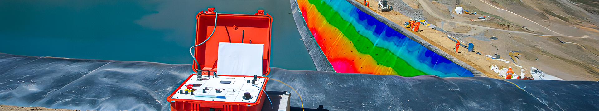
- Detection of seepage and saturated zones in dams
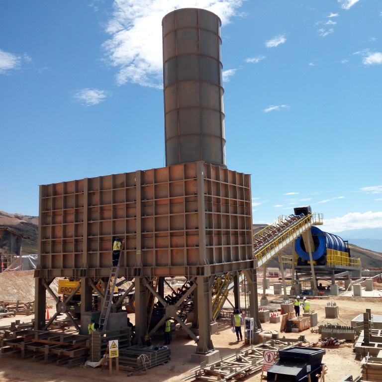
- Leak detection in liner systems for leach pads and dams
- In-situ monitoring for irrigation control and identification of saturated zones in leach pads.
- Landslide assessment in saturated soils
- Electrical resistivity profiling for the detection of karst features and/or cavities
- Identification of geological faults
- Determination of P-wave and S-wave velocity profiles for physical stability analyses of slopes and foundations
- Calculation of dynamic parameters (Poisson’s ratio, elastic modulus, and maximum shear modulus) in soil and rock from P-wave and S-wave velocity profiles
- Determination of the fundamental vibration period of soil deposits, buildings, and/or structures
- Assessment of rock rippability
- Estimation of bedrock depth and quality
- Estimation of material thickness in quarries and borrow areas
- Soil characterization for grounding systems
- Blasting vibration monitoring
- Soil compaction control
- Delineation and characterization of contaminant plumes
- Monitoring of contaminant plume migration
- Location of septic systems, pipelines, and buried infrastructure
- Detection of underground leaks and seepage
- Detection and localization of concrete cracking
- Groundwater flow mapping
- Detection of shallow and deep aquifers
- Detection of saline intrusion in aquifers
- Delineation and characterization of contaminant plumes
- Monitoring of contaminant plume migration
- Localization of septic systems, pipelines, and buried infrastructure
- Detection of underground leaks and seepage
- Detection and localization of concrete cracking