Carlos Iparraguirre has worked on water resource management projects in infrastructure for mining facilities, addressing challenges from water resource assessment to efficient water management. His experience includes guaranteed water availability for communities, hydrogeological investigations, road drainage, flood defense works, and standards design. His ability to integrate hydraulics and hydrology disciplines into effective solutions from the beginning to the end of projects stands out.
To align mining projects with environmental and sustainability regulations, he emphasizes comprehensive on-site water management planning, continuous environmental monitoring, and the adoption of sustainable technologies.
Regarding the identification and mitigation of hydrological risks in infrastructures, he proposes a comprehensive approach that includes risk assessment, hydrological modeling, resilient design, emergency planning, community participation, and continuous monitoring.
Finally, he highlights the positive impact of technology and innovative tools in hydraulics and hydrology, such as advanced modeling, the integration of satellite data, real-time sensors, and geographic information systems, which have improved accuracy and efficiency in water resource management.
Could you share experiences about your participation in water resource management projects and describe how your expertise in hydraulics and hydrology was crucial to the success of the project?
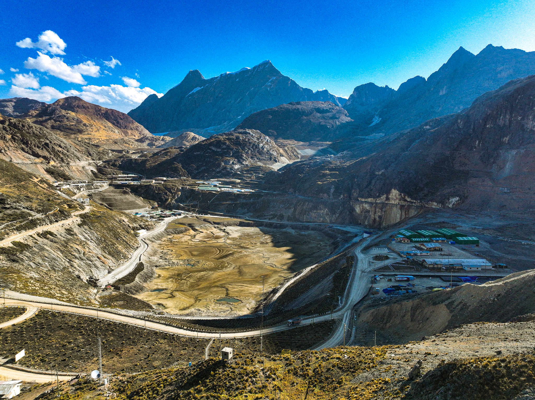
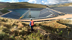
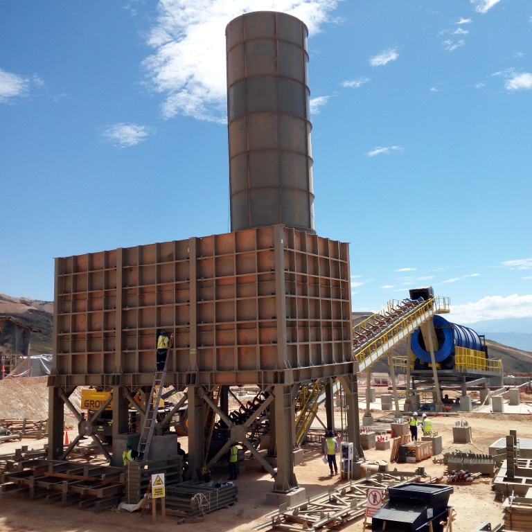
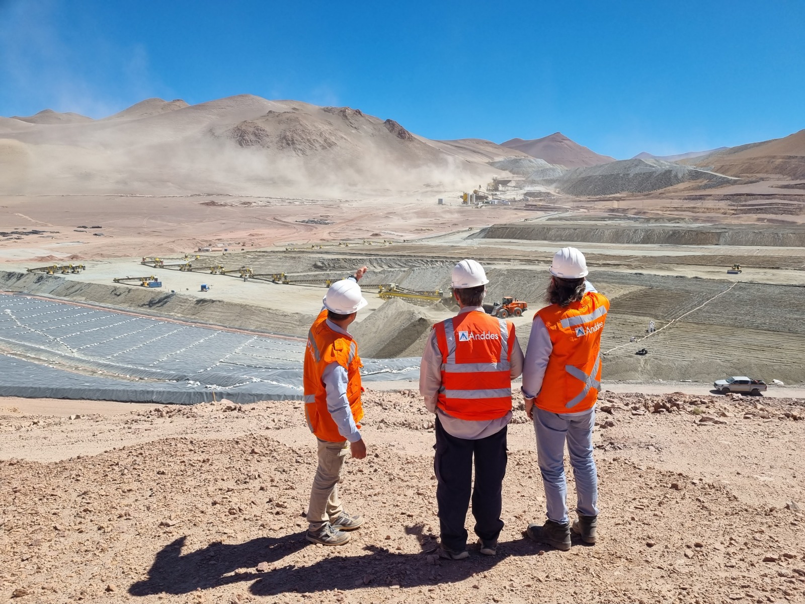
At Anddes, I have participated in infrastructure projects for mining facilities such as tailings dams, leaching pads, waste dumps, and other major components, to address the challenges of water resource management, from water resource assessment, hydraulic infrastructure design, to risk assessment and finding opportunities for efficient water management. Before joining Anddes, my experience focused on assured water availability for HPPs, hydrogeological investigations and models, drainage of transport routes, riverbank protection works against flooding, urban drainage; designs and generation of standards. My knowledge in different disciplines of hydraulics and hydrology has shaped integrative skills that have significantly contributed to the effectiveness of the proposed solutions for supply, process water management systems, as well as excesses, with the vision of development from start-up to closure.
My experience in hydraulics and hydrology has been crucial in various aspects. In addition to having a mastery of analysis and design tools, it has allowed me to properly establish the guidelines for each specific project, according to the plan with permanent and temporary facilities, and footprint growth throughout the life of the operation. My experience was also important to develop proprietary tools, procedures, and controls so that the hydrological, hydrogeological, hydrogeochemical, hydro-environmental models, led by various specialists, are integrated and maintain coherence; to expand the focus normally oriented to the area of operation towards the area of influence and provide credible information to support a good relationship with the communities and interested organizations.
Naturally, the wealth of experience is very useful to identify and evaluate water-related risks with consequences for physical stability, water quality and discharges, and identify the most viable prevention and response measures.
How do you ensure that the mining projects you participate in are aligned with environmental and sustainability regulations, considering the specific hydrological aspects of the environment?
To ensure that mining projects are aligned with environmental and sustainability regulations, some key aspects are:
Comprehensive planning for water management at the mine site, including measures to minimize water pollution, proper effluent management, and conservation of local water resources. This may involve the implementation of wastewater treatment systems, the construction of infrastructure for sediment control, and the reuse of water in the mining process.
Continuous environmental monitoring to assess the project’s impact on local water resources and ensure compliance with environmental standards. This involves regular measurement of water quality, monitoring of river and stream flows, and assessment of groundwater levels.
The adoption of sustainable mining technologies and practices that minimize water consumption, reduce waste generation, and promote the conservation of natural resources. This may include the use of water recycling techniques, the implementation of tailings management systems, and the adoption of more water-efficient extraction processes.
What is your approach to identifying and mitigating hydrological risks in hydraulic infrastructure projects, such as floods or water scarcity?
To identify and mitigate hydrological risks in hydraulic infrastructure projects, such as floods or water scarcity, a comprehensive approach must be adopted that involves several stages:
Risk assessment, which begins by conducting a thorough identification of the potential hydrological risks associated with the project. This involves evaluating the availability of surface and groundwater and water demands, both present and projected into the future, taking into account the hydrological variability of the region and its susceptibility to fluctuations and climate change, depending on the life span of the project, closure plans, and interaction with communities.
Hydrological modeling to simulate different hydrological scenarios and evaluate how critical situations of flooding, maximum and minimum flows, as well as prolonged droughts and conflicts of access to water or environmental conservation, could affect the project.
Identification of vulnerabilities to the identified hydrological risks, such as the location of critical infrastructure in areas prone to flooding or the dependence on water sources vulnerable to scarcity.
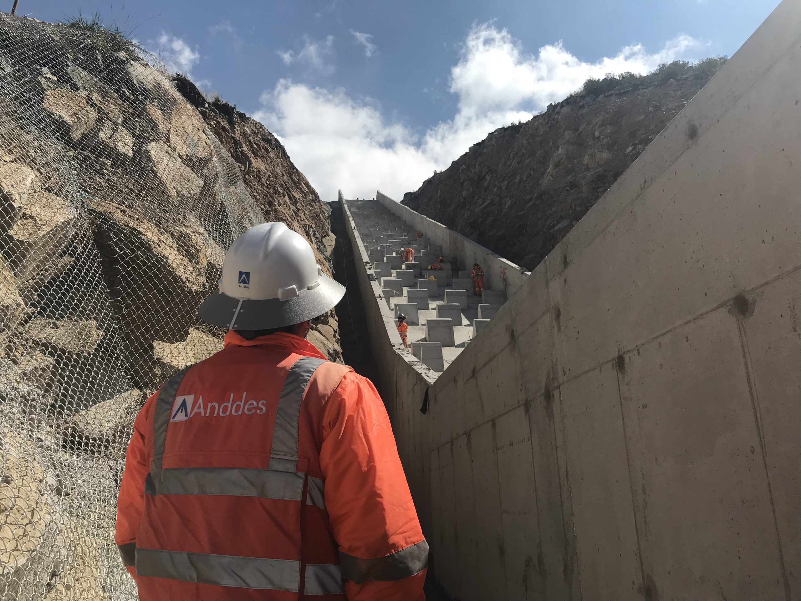
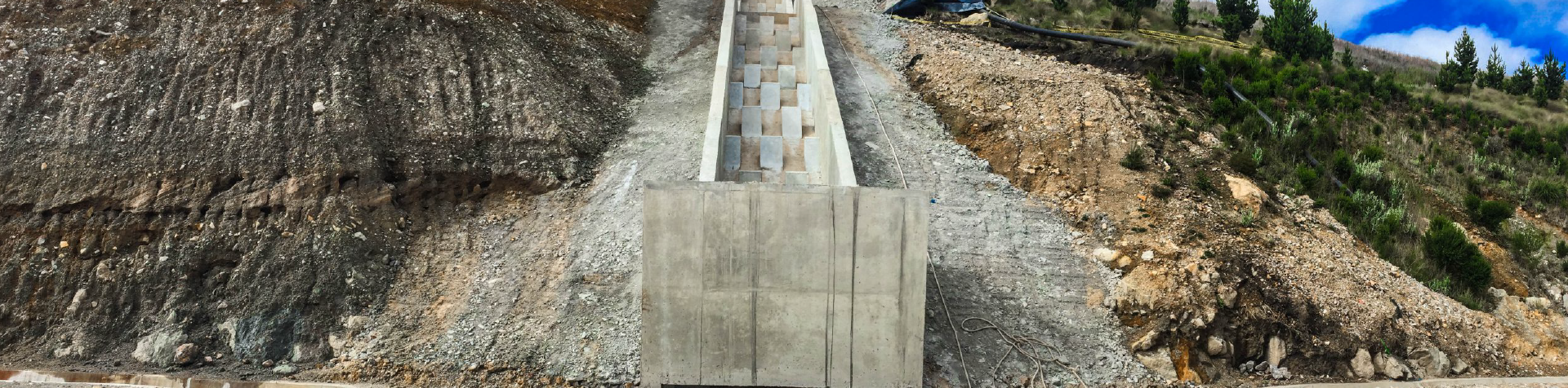
Resilient design to incorporate design measures that reduce the project’s vulnerability to extreme hydrological events. This may involve moving or elevating structures above expected flood levels, limiting erosion, implementing adequate drainage systems that facilitate cleaning, or using water-resistant materials.
Emergency planning, developing emergency and response plans for extreme hydrological events. These plans include evacuation protocols, early warning systems, and contingency measures to ensure the safety of people and infrastructure, and preventive action against droughts.
Community participation to involve local communities in the process of identifying and mitigating hydrological risks. This may involve raising awareness about water conservation practices, participating in the planning of mitigation measures, and training in emergency response.
Continuous monitoring and review to establish continuous monitoring systems to evaluate the effectiveness of the mitigation measures implemented and make adjustments as necessary. Real-time hydrological monitoring allows for a rapid response to changes in hydrological conditions and the early identification of new risks.
By adopting this comprehensive approach, hydrological risks in hydraulic infrastructure projects can be effectively identified and mitigated, ensuring their resilience to extreme events and promoting sustainable water resource management.
Could you discuss how technology and innovative tools in hydraulics and hydrology have impacted your work in water resource management in recent years?
Of course, technology and innovative tools in hydraulics and hydrology have had a significant impact. Some of the innovations that have transformed my work for the better include:
Advanced hydrological and hydraulic modeling: Hydrological and hydraulic modeling tools have experienced significant advances, allowing for more accurate simulation of the behavior of hydrological systems and the dynamics of flows in hydraulic structures. These models can more faithfully represent the complexity of water flows in rivers, basins, and distribution systems, facilitating informed decision-making in water resource management and the efficient design of hydraulic works systems, which is very useful in facilities where space and shape limitations lead to unique solutions that would otherwise have to be evaluated by physical models that take more time and resources.
Integration of satellite data: The use of satellite data to monitor changes in water resources has improved the ability to understand and manage water systems at medium and large scales, and to build statistically more robust models. Remote sensing provides information on surface water distribution, evapotranspiration, changes in vegetation cover, and other parameters relevant to the modeling, monitoring, and management of water resources.
Sensors and real-time monitoring technology: The availability of sensors and real-time monitoring technology have revolutionized the way hydrological information is collected and analyzed. These devices provide accurate and up-to-date data on key variables such as water levels, river flows, water quality, and weather conditions, enabling more efficient and proactive management of water resources.
Geographic Information Systems (GIS): GIS have improved the ability to integrate and visualize spatial data related to hydrology and water resource management. These tools allow for the analysis of the spatial distribution of water resources, the identification of areas vulnerable to floods or droughts, and the more effective planning of land and water use.
In summary, technology and innovative tools in hydraulics and hydrology have improved the accuracy of assessments of the quantity and quality of the resource, as well as its fine-grained spatial and temporal distribution, to improve the efficiency of water resource management.